
Climate Crunchers| Rising Water
Project Details
The Challenge | Rising Water
Rising Water Simulation
Our project is a web-based VR simulation to help visualize the impacts of rising water and climate change.
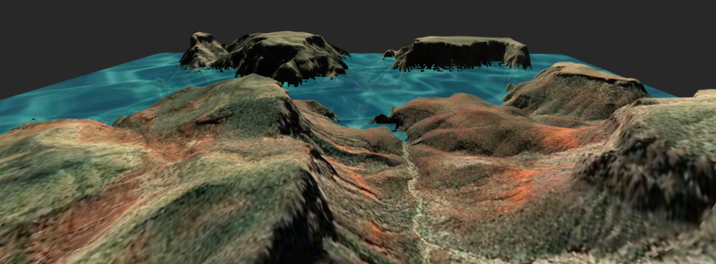
Our intent was to create a VR project to help visualize the impacts of climate change.
We used a number of open-source tools and technology: Web.gl, Three.js, A-Frame, A-Frame Aterrain Component, A-Frame GIF Shader, and A-Frame Camera Transform Component, The A-Frame Aterrain Component uses geospatial data from Cesium. With funding for an API license, our tool could visualize the user's hometown or other recognizable areas to help better communicate potential impacts.
Because we built this on top of A-Frame, this project works on most desktop and mobile browsers, VR and AR headsets.
We would like to incorporate real-world prediction data to show estimated water levels for specific locations over time in an interactable way. The Milwaukee event only had a venue for Saturday so we were unable to reach that goal.
The project is live and available here: http://ablaze-gallimimus.glitch.me/?waterStart=-900&waterRise=100&loop=true&duration=10000
The source code is available here: https://glitch.com/edit/#!/ablaze-gallimimus?path=index.html:1:0