
CTTH BloodTrail| Rising Water
Project Details
The Challenge | Rising Water
Deep in the water
We want people take another way to face the problem, which have been discussed for years.
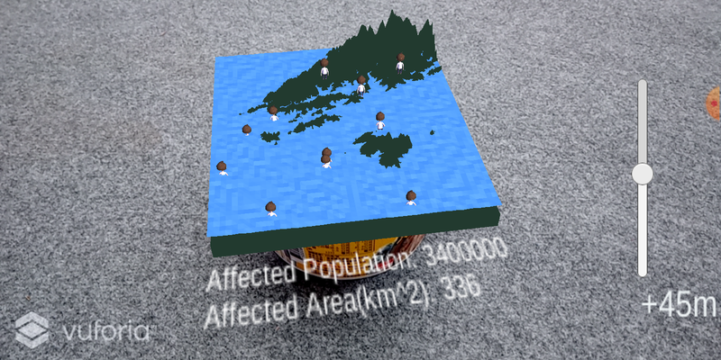
With the sea level getting higher and higher, either the cities or the countries have trouble in handling with the rising water level. To raise people's awareness of the crisis, we use AR technology offered by unity and some statistics to build model of specific terrains, then the users can slide the button to see what may happen after the sea level rising. This model can not only simulate the flood but also can predict other disasters since the application of the big data is gradually becoming mature. For example, because the nuclear reactors need a lot of water to cool down, those nuclear power plants usually built near the seashore. As we mentioned before, the increasing sea level is a threat to who live around those power plants. If we can evaluate the time before the dangers, we can prevent those tragedies from happening.
What we used:
- 3D models of terrains
- AR technology
- Statistics of sea level rising rate, the area of land, population
- Our brains
Github: https://github.com/mendelmaker/deep-in-the-water
Link of powerpoint and source code: https://drive.google.com/drive/folders/10untoyLPRp...