
MENDO CHANGERS| From Curious Minds Come Helping Hands
Project Details
The Challenge | From Curious Minds Come Helping Hands
Bonding for people in need
We are a collaborative network that connects people and empowers natural disasters victims, people who want to help either with money, donations or time &public and private organizations. We achieve faster and long lasting results by rewarding our donors.
- About Us
We are a Mecatronics Engineer (Luis), an English Teacher and professor (Miriam Nancy), an Economist (Daniel), an Industrial Engineer (Irene) and an Information Systems Engineer (Gustavo) united to serve our community by using our skills and devoting time to making our society a better place to live in.
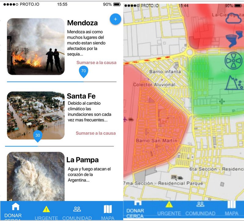
Problem
The first problem we consider is the difficulties vulnerable populations endure especially during a natural disaster.Spotting these places is essential to ensure operational success. The second issue that concerns us is the mounting difficulties that people who want to collaborate face during natural disasters. Everything gets too complicated and time-consuming, and this dramatically impacts on deployment times and rescue efficiency. We also reward people who do good things for the community.
Solution and Value Proposition
There are different apps that aim at offering help through donations or contingency plans during disasters . What makes our app different? We provide our app users with a package of benefits that empower victims of disasters and reward people who do good things for people in need.
👥 If you are a victim you can:
- access to an offline step to step emergency guide
- let people know about your whereabouts
- get help faster and more efficiently
👥 As a donor you can:
- get updated data about communities at risk. Our server crossmatches the user's current location with the atmospherical and geographical conditions in that moment through NASA's AQUA and TERRA's satellites missions. This data is reliable because it is also assessed by a multidisciplinary team composed of specialists with varied and complementary qualifications, experience and skills ( students doing internships as social workers, psychologists etc),
-take part into solidarity campaigns by donating things (clothes, food, drinkable water, etc), time (helping rebuilt houses, joining rescue teams, attending seminars about disaster awareness, disaster prevention and disaster management) and services ( giving seminars about disasters, providing professional expertise and service as doctors, psychologists, nurses, engineers, etc),
-tailor your donations journey and keep track of them,
- be rewarded by getting app ranked higher according to your commitment ( shown through donations, loggings, sharing the app information with friends, etc. ) and getting bonus points in discount vouchers,
- be supported by an app privacy policy.
References:
https://aqua.nasa.gov/content/images-data
https://catalogos.conae.gov.ar/catalogo/catalogoSa...