
Project Details
The Challenge | From Curious Minds Come Helping Hands
Dulce
Intelligent information system for people who transit on risk areas. Standalone platform Dulce which will send alerts, will be connected to satellites and micro weather stations. Dulce will use the safety net of telephone operators through SMS and calls.
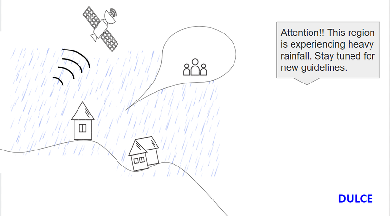
Satellite-connected warning system (Suomi-NPP) which together with sensors located in micro weather stations (powered by solar energy) will inform the population that is in the risk area about possible landslide.
When the level of precipitation, humidity, wind speed exceeds the specified limit, the intelligent system DULCE that is connected to at least two operators will ensure that information is reported.
DULCE will cross the data along with the satellite information and send the alert to the population around the perimeter with information sent via SMS and calls, if the telephone signal is not working, the operators' safety net will be used.
The information will be transmitted to the central office that will store the data, integrated with public agencies in order to solve recurring problems.