
Eye OF Horus| Set Your Sights High!
Project Details
The Challenge | Set Your Sights High!
Eye OF Horus
Eye OF Horus is a web app we designed to solve our challenge “set your sights high”. It’s a simulation of the earth, the surrounding satellites, space debris and displays all of their information and data when asked to, like an interactive 3D map.
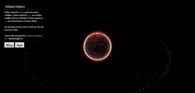
From the very first moment that we decided to work on this challenge, we had an overview in our minds, and till now we have reached a lot of what we expected to do. We built a dynamic web app which a simulation of the globe and every satellite that's out there with all of the information about them concluding (Name, country, NORAD ID, perigee, apogee, size....etc) and the satellite's orbit around the globe, all of that is displayed to the user when requested (clicking on the satellite). Our site is made with HTML, CSS, JS with Three.min.js and Tween.js (open source codes), in addition to Web GL toolkit, jQuery and other bootstrap libraries. This meets all the challenge requirements and more. We hope that it will provide an interactive, new, way of learning and showing data.
Web page link: https://www.eye-of-horus.live
Source code: https://github.com/drymak/eye-of-horus/
Presentation link :https://drive.google.com/open?id=1yiTindUvJosmWOxO...