
save the banana| Show the World the Data!
Project Details
The Challenge | Show the World the Data!
Intelligent Crop Planning and Harvesting Using Graph Theory, Neural Network and sUAS
Overlapping Patchwork Plantation as a replacement for crop rotation for model way of plantation
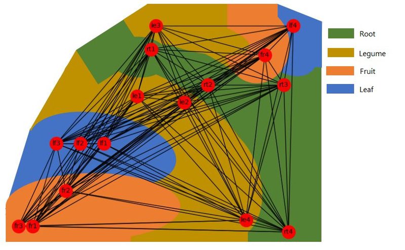
Overlapping Plantation is a highly mathematical model for plantation industry, which utilize graph theory to map out the distances between plants and nutrients that can be spread out to the targeted crops. We used NASA WorldWind as a model for us to get the contour of the desired location as well as the conditions of the selected location for simulation. We also trained a neural network to suggest the optimum ways in arranging the crops to achieve the desired spread of nutrients.
Our project solves the problem of crops spreading which are hard to be sowed, maintained and harvested by manpower. However, this problem could be solved when we discovered NASA have another project: small UAS which can be modified to maintenance the crops. Pairing up with UAV and the trained network, this seemingly impossible job for human can be fully automated, providing the maximum yield, most efficient way for plantation, reducing grain used and least harm due to natural landscape.
The Suggested Algorithm is attached.
Impacts
- Increase yield and fertility of the land.
- Provide extra revenue.
- Conserving the nature and efficient use of land.
Reference: