
Peacekeepers| Smash your SDGs!
Project Details
The Challenge | Smash your SDGs!
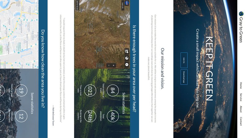
Gray To Green
Creating a change on the environment by keeping people updated with accurate garbage location in map, mapping tree vs man ratio.
Overview:
We built an app that can show man vs tree ratio. Besides, for a cleaner environment, the app can show garages detected by users to map through GPS.
Challenge:
1. Gathering dataset.
2. Two features in one application.
3. Unexpected output after compiling.
4. Time maintaining.
Resources
How the images will be processed based on time and patten of the article given bellow
https://earthobservatory.nasa.gov/features/ColorIm...
Images are been taken from NASA Satellite
https://search.earthdata.nasa.gov/search/granules?...
https://earthexplorer.usgs.gov/?fbclid=IwAR1PGEhJq...
https://search.earthdata.nasa.gov/search/granules?...
We are also looking for more suitable dataset, will be added if we get any
We used this link to set up our details and web site development
https://earthdata.nasa.gov/collaborate/open-data-s...
https://earthdata.nasa.gov/collaborate/open-data-s...
Third party source-
Google map
Images
GitHub Link: https://github.com/CS-Ponkoj/Gray-To-Green