
Code Red| Spot That Fire V2.0
Project Details
The Challenge | Spot That Fire V2.0
Your challenge is to create an application that leverages NASA's near-real-time and archival wildfire datasets along with other tools to support firefighting and fire mitigation efforts. This challenge builds on last year’s challenge of the same name by calling for innovative ideas and apps that focus on how to engage and enable citizens to assist with the entire firefighting and fire mitigation process.
Code Red
Our app was designed to alert citizens and also safety and environmental authorities about ongoing fires near their area. It also provides a map so the user can check other areas as well, and it predicts the probability of a fire happening.
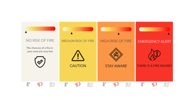
Our team is composed by students of Computer Science, Computer Engineering and Information Systems. Our goal is to help people be aware of the probability of fires happening near their area, and it also aims at being a good resource for firefighters, police officers and environmental authorities since they can check the map and look for areas where there is a fire happening, or a high probability of it, and help.
Resources:
- Java
- Adobe Xd
- Android Studio
- Cordova
- Python
- Git and GitHub
- VIIRS Active Fire Detection Data from 2019
- IBGE (Brazilian Institute of Geography and Statistics) data
- Tableau