
Dracarys Solutions| Spot That Fire V2.0
Project Details
The Challenge | Spot That Fire V2.0
Your challenge is to create an application that leverages NASA's near-real-time and archival wildfire datasets along with other tools to support firefighting and fire mitigation efforts. This challenge builds on last year’s challenge of the same name by calling for innovative ideas and apps that focus on how to engage and enable citizens to assist with the entire firefighting and fire mitigation process.
Natives In Peace
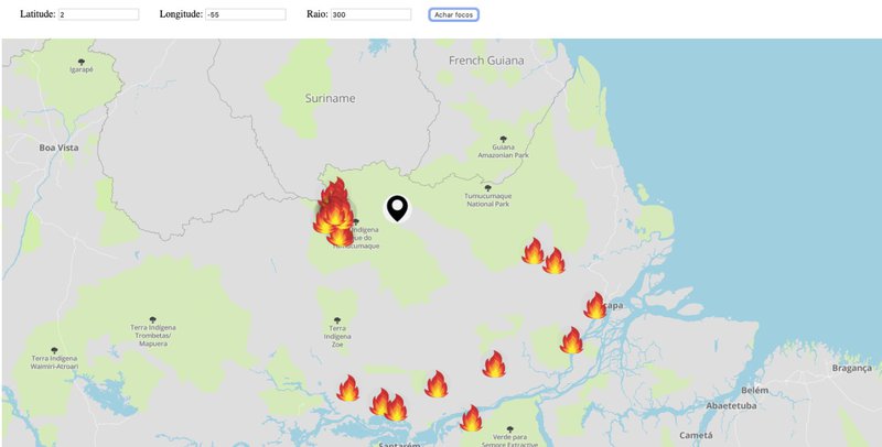
A web app that shows the firespots near the user, in a variable range.
https://github.com/Dracarys-Solutions
We faced some problems getting the NASA data fromNatives in peace VIIRS and MODIS on the right format, it caused us to lose a lot of time and because of this we were not able to develop much fetures into the application. We planned to show safe areas, like short and/or green vegetation fields near that place. Control either the fire is on a protected area or not and to check if any comunity would be isolated because of the fire.
During the process we learned a lot about requesting informations from different services, learned how to access NASA data and how they can be usefull to a lot of things, and how big things can be when you work together, seing NASA and our team as an example.