
ET760| Spot That Fire V2.0
Project Details
Awards & Nominations
ET760 has received the following awards and nominations. Way to go!
The Challenge | Spot That Fire V2.0
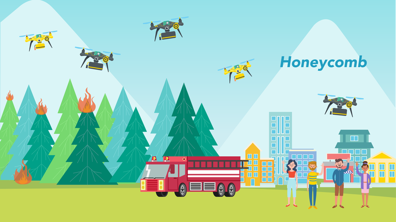
Honeycomb Platform
Many hands make light work! Join the “Honeycomb” platform to fight with wildfires together!
Foreword
The wildfires are increasing in frequency and impact. More than 200 million acres were burnt in southern California, the Amazon rainforest, and Siberia this year. While we might be able to rely on the government’s firefighting resources to put out a wildfire, the wildfire cannot be controlled without timely detection and immediate response. Therefore, we designed an intelligent reconnaissance and wildfire prevention platform, called “Honeycomb”, which can mobilize the citizens to fight wildfires. With safety as a top priority, the platform enables civilians to be part of the disaster relief in case of wildfire. All citizens are able to participate and have pride in their contribution in stopping wildfires.

1. Introduction: Honeycomb and Fire Bees
The “Honeycomb” platform can gather up the public to fight against wildfire. It can stop a small fire from growing out of control. In the event of a forest fire, the "Honeycomb" can minimize the damage.
We built up a system that can prevent and put out a wildfire in a more efficient way by using drones. The system is managed by an AI model that can predict the risk of a regional fire and control all the drones. We used the Forest Fires Dataset released by the University of Minho to train an AI model via machine learning, and we implemented the model with the NASA OpenNEX dataset and the NASA Fire Information for Resource Management System (FIRMS) dataset to assess the risk. In addition, we designed a deep learning model for object detection.
In the operation of Honeycomb, we first invite those who have drones to join the "Fire Bees Program". Once they register with our system, their drones will become one of the smart wildfire patrollers or fighters in our system. Meanwhile, all drones’ status and the updates of a wildfire are made available in real time to everyone involved so that necessary actions can be taken immediately.
In nature the bees help each other out when the colony faces life-threatening situations. Inspired by this characteristics of bees, we designed this platform to mobilize the crowd to address the challenge of a wildfire. The "Honeycomb" is not just an AI wildfire prevention system. It is home to the "Fire Bees".


2. Functions
The Honeycomb Platform includes the following functions:
- Wildfire risk predicting models
- Dispatch system of smart drones
- Wildfire monitor app
- Drone charging stations
More details are described below.
2-1. Wildfire risk predicting models
To build a first-step model, we utilize the NASA OpenNEX dataset, which includes information about the humidity, temperature, and wind speed across the world. The model predicts the potential risk of a wildfire worldwide. Once the model detects that a wildfire is at high risk to be triggered, the “Honeycomb” will send the patrolling drones to check and monitor the status. The model is trained with the extra-tree regressor and the Forest Fire Dataset by the University of Minho. In this dataset, it records the temperature factors and the burning area size. We assume that the burning area could be represented as the serious level of wildfire.

Furthermore, if the NASA Fire Information for Resource Management System (FIRMS) circulates the notice of a fire, we will multiply the results of our model and the presumed distance index to assess the scale of the fire.

2-2. Dispatch system of smart drones
We equip the drone with flame retardant sprayer, alarm system, thermometer, and AI camera. Moreover, we classify the drones into two types: firefighters and patrollers, depending on the loading capacity of the drones. For drones with larger capacity, we assign them as firefighters; the smaller drones are assigned as patrollers, equipped with less amount of flame retardant.

The main functions of the firefighters include:
- Carry flame retardant. The “Honeycomb” flies the firefighters to the spot of the fire in order to assist the firemen or the traditional firefighting system against the fire. While the drones may not serve as a complete alternative of a firefighting system, they can assist reduce the damage, especially in a coordinated manner that may be complementary to a traditional system.
- Restore the forest. After the fire is put out, the firefighters can be utilized to restore the forest by sowing or watering.
The main functions of the patrollers include:
- Alarm and guide. The patrollers can use their speakers and warning lights to guide people for escaping or into safety shelters. Meanwhile they can also make sounds of particular frequencies to keep animals away from the fire region.
- Provide the latest information of a fire. With the equipped thermometers and the AI cameras, the patrollers can provide the App with instantaneous information. Besides, the AI cameras can detect objects or recognize vegetation. We have developed a smoke detection model with the YOLO-based deep learning framework.
- Patrol and fire prevention. The patrollers can help us to fill data gaps in the timeline and find spots of fire in the early stage. In addition to the regular patrol, the patrollers can also inspect the regions where our fire risk model predicts with high wildfire risk.

2-3. Wildfire monitor app
People can register their drones as “Fire Bee” in our app, which provides instantaneous information for fires and indicates the safety zones on the regional map. Through the app, people and firemen can also watch the drones at work. The information provided by the drones includes the status, power, and real-time views.


App link: https://scsonic.github.io/NASA2019_et760/web/stati...
2-4. Drone charging stations
We have many drone charging stations in our Honeycomb system. The need comes from the fact that once a wildfire occurs the demand of drone charging increases. Thus our system invites even those who have no drones to participate by setting up emergency-ready charging stations at their home locations. In this way we can reduce the concern of power scarcity for operating the drones in a fire.

3. Operation Scenarios
Prevention: Our predicting system of wildfire indicates a location with high risk. The Honeycomb sends a group of patrollers to monitor the location and later finds campfire embers. The Honeycomb immediately dispatches the firefighting drones to cease the embers.
Firefighting: WARNING! WARNING! NASA discovers a wildfire in a forest and reports to the local fire department. A group of firemen arrive at the fire site and soon find that a hundred of firefighting drones arrived earlier to have controlled the wildfire so that the firemen can then put out the fire with reasonable amount of effort.
4. Future Work
- Develop drone route algorithms
- Develop drone intercommunication system
- System integration
- Improve the fire risk model. We plan to use more data, such as vegetation and carbon dioxide, to optimize the accuracy of model prediction.
- Strategic policy to encourage drone ownership:
- Promote drone usage for farming (e.g. to spray insecticide).
- Encourage drone owners to join the Honeycomb by providing incentives such as waiving the drone-charging fees.
5. Related Link
- App link: https://scsonic.github.io/NASA2019_et760/web/stati...
- App source code: https://github.com/scsonic/NASA2019_et760
- Fire risk model source code: https://github.com/sushangyen/ET760_Fire_Index_Mod...
- Smoke detection model source code: https://github.com/scsonic/ET760_SmokeDetection
- Presentation slides (Chinese version): https://drive.google.com/file/d/1n95tdGIlw0LUAZcXB...
6. Reference
- Wildfire stats from Insurance Information Institute: https://www.iii.org/fact-statistic/facts-statistic...
- NASA FIRMS: https://firms.modaps.eosdis.nasa.gov
- NASA OpenNEX: https://nex.nasa.gov/nex/static/htdocs/site/extra/...
- Global Meteorological Forcing Dataset for land surface modeling: https://nex.nasa.gov/nex/resources/364/
- Forest Fire Dataset by the University of Minho: http://www3.dsi.uminho.pt/pcortez/forestfires/
- Pixhawk Autopilot: https://pixhawk.org/