FireAway | Spot That Fire V2.0
Team Updates
Summary
FireAway is an API (Application Programming Interface) with the goal of providing data, so that apps with geolocation, GPS (Global Positioning System), indicate a safe route, this way avoiding having citizens in danger zones, that is, places where forest fires are close to roads.
Problem
People in general don’t have in their hand the information as to where are zones that could have forest fires in real time. A lot of citizens go in danger zones because of the lack of awareness, resulting in: difficulties in the work of fireman because of unorganized traffic formation, deaths and accidents because of the lack of visibility caused by the smoke and winds that carry and move fires causing tragedies. It is knowledgeable that one of the main problems around this, is the lack of awareness and information on almost real time data, in a efficient and applicable way.
Solution
We developed an API that provides data, in almost real time, of the high risk danger zones caused by fires, to geolocation apps (like, waze, Google Maps, Apple Maps etc), which shares those information with the population through safe routes. This solution lessens the unorganized traffic in high risk zones, facilitating the job of firefighters to put the out the flames, still ensuring the users safety.
Struct
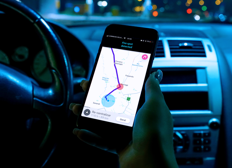
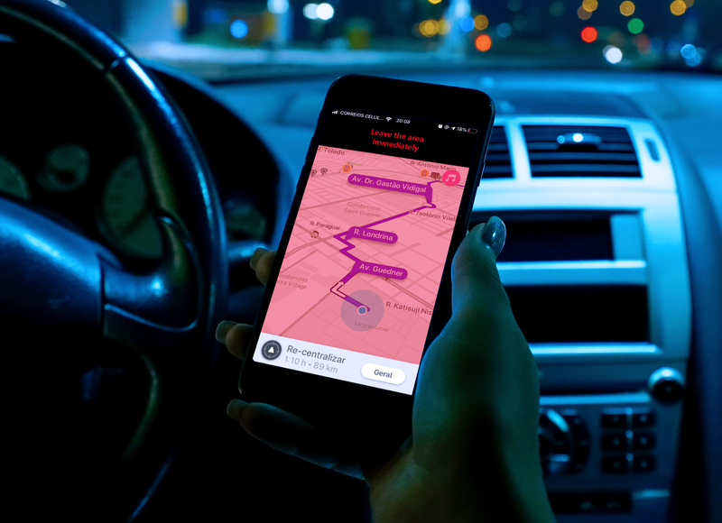
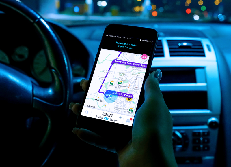
The project was developed with the goal of defining danger zones related to forest fires, that way, enabling the data for geolocation apps. These zones can be detected by a quick data analysis of two APIs. The VIIRS api (Nasa Data) - which provides the information in almost real time about where fire hotspots can be found, and the Yahoo Weather API - which provides real time meteorology data - that way we know the direction and speed of winds, enabling the prediction of where a fire might spread and locating unsafe regions. Furthermore, there is a calculus utilizing the data from both APIs to detect zones where harmful excess smoke might spread to people passing by the area, especially drivers who lose their vision on the road because of the smoke.
These zones are calculated and sent in Json format to geolocation apps, so they can alert their users getting nearby the risk zone, moreover, defining a new safer route away for the problems caused by the fires.
Conclusion
The project enables an efficient connection between different data and tools about geolocation close to people. Creating a complete and safe experience for the users as well as well as reduction in traffic caused by danger zones, facilitating the work of firefighters and ensuring the safety of the users, providing them a new route.