
Forest Army| Spot That Fire V2.0
Project Details
The Challenge | Spot That Fire V2.0
Your challenge is to create an application that leverages NASA's near-real-time and archival wildfire datasets along with other tools to support firefighting and fire mitigation efforts. This challenge builds on last year’s challenge of the same name by calling for innovative ideas and apps that focus on how to engage and enable citizens to assist with the entire firefighting and fire mitigation process.
Fire's fate alarm
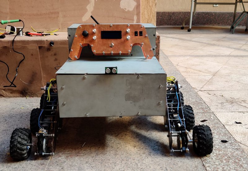
our curiosity rover uses NASA's data to scan a specific area, detect fires, and create detailed maps.
Our project follows four main procedures:
- Rover stations monitor NASA’s near-real-time data and active fire data to spot any unusual phenomena.
- Rovers are released to explore threatened areas.
- Using different sensors, rovers collect significant data, including temperature, air speed, wind direction, and the spread of smoke and flame. Besides, the rovers provide a complete visualization of the area by using raspberry-pie camera and ultrasonic sensor.
- Rover stations analyze the gathered data and make a detailed map for the endangered area in order to determine the exact source of the fire and guarantee safe routes for firefighters and citizens.