
GreenFire| Spot That Fire V2.0
Project Details
The Challenge | Spot That Fire V2.0
Your challenge is to create an application that leverages NASA's near-real-time and archival wildfire datasets along with other tools to support firefighting and fire mitigation efforts. This challenge builds on last year’s challenge of the same name by calling for innovative ideas and apps that focus on how to engage and enable citizens to assist with the entire firefighting and fire mitigation process.
Stop Fire
Stop Fire objective is to warn civilians or autorities when a wildfire occours
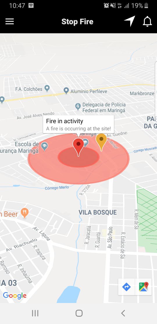
Stop Fire task is to warn and spot wildfires on risky areas. Users can send photos of the wildfires, and authorities got priority warnings on those lists.
Those warnings has info like air humidity, direction of wind, chances os rain and areas that can be affected by the wildfire.
The app uses an API called FIRMS (FireInformation for Resource Management System), from an satellite who got information from wildfires in the world every hour. It uses an google maps API, that is responsible to calculate safe routes and blocked spots on every route you would get.
Mixing those two API's, we got warnings on every wildfire, plus safe routes for our users.
Made with Apache Cordova and Mobile UI.
GitHUB