
Project Details
Awards & Nominations
Zuko has received the following awards and nominations. Way to go!
The Challenge | Spot That Fire V2.0
Zuko: AI Based Fire Bender
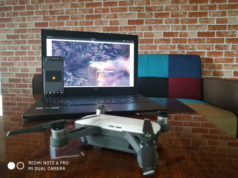
Zuko is a crowd-source and AI Surveillance platform that enables end users to report fires and help them with rescue paths while the AI based Surveillance Drone autonomously charts satellite data, detects fire and predicts its path using Computer Vision.
Inspiration
There are about 58 thousand wildfires that occur across the globe engulfing natural and man-made habitats. When we chose this challenge, our aim was to enhance the Fire Validation process and provide a crowd-sourcing application. With the advent of technologies like Computer Vision and Deep Learning, our mission, that we chose to accept (Mission Impossible reference), was to create an Convolutional Neural Network Based Object Detector that would be capable of recognising fire in an RGBA image and a crowd-sourced mobile application that would help it's end users to report fires and follow rescue paths. This Neural Network of ours would be used both in the crowd-sourcing application for validating the fire images and by our drone for search and predict operations.
Breakdown
I'll breakdown the components of our solution to make it simpler.
- Crowd-sourced application that had the following features:
- Report wildfires by clicking pictures
- Show geo-fenced regions of wildfires
- Plot rescue paths on Google Maps to get to safety
- Provide general guidelines in an event of a wildfire to better help one-self and firefighters.
- A central server that constantly checks NASA's near-real-time fire anomalies data from VIIRS and MODIS, cleanses this data and applies Kurskal's Algorithm to chart the shortest path between the lat-long positions
- A CNN based Object Detector capable of recognising and localising fires in RGBA images. The Object Detector was trained of fire images scrubbed off the internet using web crawlers. It had two main uses:
- Validate the crowd-sourced images
- Provide fire recognition capabilities to a drone
- An Autonomous drone that had the following features:
- Follow the aforementioned shortest path
- Recognise and validate the presence of wildfires using our Object Detector
- Hover and analyse the rate of spread and direction of the wildfire
- Recognise presence of humans and animals and report to the nearest fire-fighting authorities.