Team Updates
Problem
Nowadays talking about air quality is everyone's topic due to the health problems that come with being in a place where air quality is very bad, "we can choose what water to drink, but not what air to breathe." Because of this in the worldwide and particularly in the most populated cities, understanding how the behavior of the atmosphere is and what parameters are influential to determine how polluted or not the air has been, which becomes in the starting point for the development of systems of alert and indicators on the air quality.
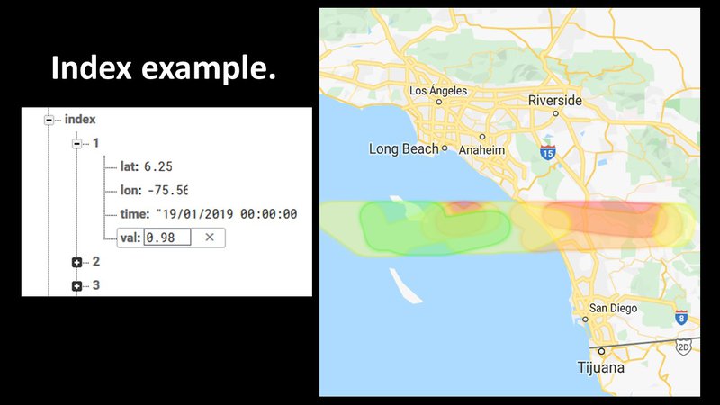
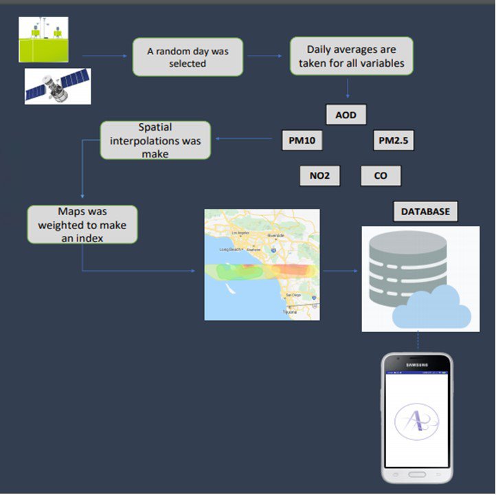
Currently these alert systems and indicators are based on information obtained from land sensors and air quality models supported by meteorological information from ground stations and satellite information, showing mainly on scales of colors and numbers, and shows how good or bad is the air quality in an area, thus make it a little more understandable to the common people. The main problem is the quality of the data that is collected, this because of how well calibrated the sensors are, in addition to the implementation of low-cost technologies, although it allows expanding the coverage of an area, they do not allow to improve the quality of the information, the current way in which the information is presented makes its interpretation polarized.
Around this information that have different sources there are many applications that result in the same: temporarily, they have color and numerical scales, supported by heat maps, concentrations of pollutants such as: Particulate material (PM), Ozone (O3), Nitrogen dioxide (NO2), Sulfur dioxide (SO2) and weather information. Although the information is clear to the reader, but it does not generate a link that transcends beyond a data that the user receives every day, causing people to lose interest in the information provided by the App, which ends in an ineffective information.