
Propulsion Team| From Curious Minds Come Helping Hands
Project Details
The Challenge | From Curious Minds Come Helping Hands
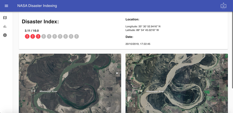
Disaster Index
A web application that Uses Machine Learning to compute a disaster index based on pre and post disaster satellite images.
Millions of people are affected by natural disasters and aid organizations are constantly struggling to estimate the amount of resources needed for victims of these events. There is a constant shortage of supplies as well as able bodies around highly damaged regions. We believe that this problem stems from the lack of knowledge of affected areas on the day of the catastrophe.
Our aim is to enable NGOs to get a first and overall glance of regions which require the most assistance. By analyzing the pre and post images of the affected area, we are able to calculate a disaster index which helps to estimate the damages around a specific region. With this, NGOs are not only able to provide resources appropriately, but also deploy them in hot areas effectively.
We initially tried to extract satellite images directly from the NASA APIs. Unfortunately, we faced constraints, such as cloud coverage and image quality. We then discovered Synthetic Aperture Radars in particular Sentinel-1, which is the perfect solution to remove cloud coverage and improve accuracy. However we were unable to use these images due to the file size being to large to download and train in the short time span of the weekend. We settled on NASA satellite images found on google and NASA articles.
The next step would be to improve the data extraction process, as well as calibrating our model to make more accurate predictions. We would also like to deploy our model and web app.
Overall, we enjoyed the NASA hackathon experience very much and we look forward to participating again next year! We have high hopes that our project will aid in improving the deployment of resources during times of crisis. Thank you for the opportunity.