
Project Details
The Challenge | From Curious Minds Come Helping Hands
Warden
Presentation video of Warden
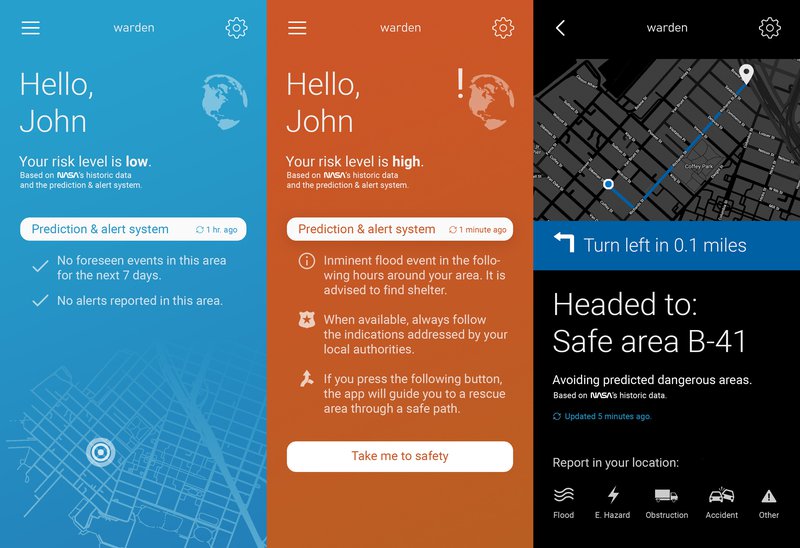
Warden is a smartphone application with an user friendly interface for detecting a flood in a dynamic way. We use a functional algorithm with some interesting environmental variables: precipitations, land use, vegetation coverage, lithology and the digital elevation model of an area. This information comes directly from NASA and other scientific institutions. Then, we extract and process the data to get an unified format with the useful data, needed to calculate the flooding probability index, which is obtained from scientific studies corroborated by experts. Once the risk index is obtained, the areas most susceptible to a flood are visualized, generating an optimal route for people's evacuation in an event of high risk. In this way, we get an early detection of a flooding, improving agricultural and civil management, minimizing the economical expenses and the humanitarian losses.