
DeFyre| Spot That Fire V2.0
Team Updates
We also made our solution available to people who don't have access to digital phones by sending SMS messages as well about the fires that currently happen near them.
We think it's a very useful feature so as to include every kinds of people. :)
The Github repository where we placed our files is at: https://github.com/johnengelo/app.oy
We had a difficulty accessing raw data from MODIS and VIIRS since we only saw the WMS API, but we decided to just use the 24 hour CSV for fire verification even if it isn't real time enough.
We were very amazed by the amount of open data that NASA provides. It really is a helpful thing for developers as well as regular civilians who want to learn more about the world around them.
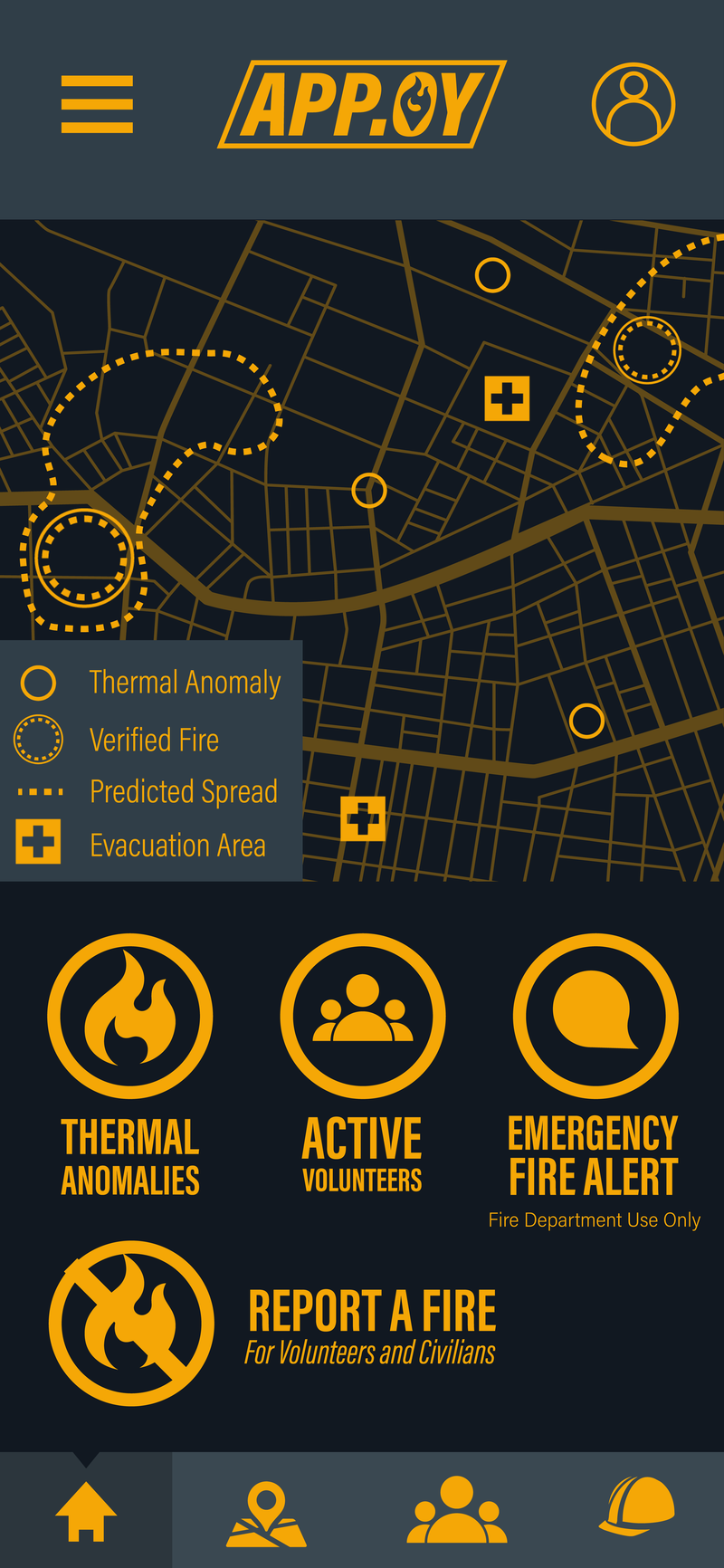
The home screen for the app

The logo we made for our app, with baybayin for Apoy or Fire.

Full screen map that displays thermal anomalies as well as verified fires in the area. The app generates a danger zone based on current wind data and weather.
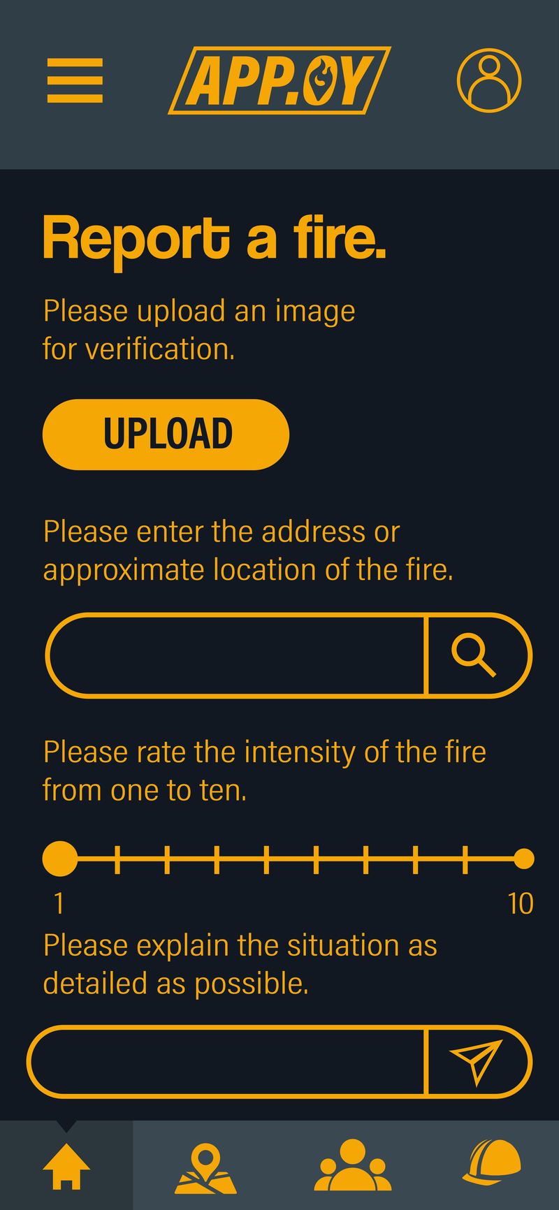
The civilian fire reporting interface