
Project Details
Awards & Nominations
GLPN has received the following awards and nominations. Way to go!
The Challenge | Eeny, Meeny, Miney, Sample!
Global Lunar Priotization Network
Our mission is to use data on resources like water and minerals, with community research needs to evaluate the most valuable resource. Then an algorithm calculates the optimised path based on the highest ranked (valued) resource chosen.
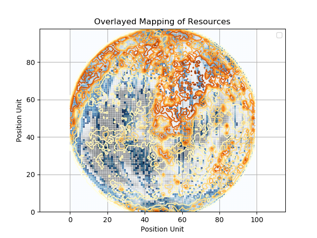
There are many things we can learn from our exploration of the moon. But where do we look? By capturing priorities across scientists who study the moon, combining this with data gathered about various resources from past NASA-led missions, we create a map that displays the most relevant and feasible zones for lunar sampling to take place.
This saves time, money, and ensures wider involvement and transparency across all citizens interested in our exploration of our moon.
Using advanced image processing techniques, we aggregate Lunar data from a range of sources to create a feasibility map of regions of potential interest.
We augment map data with feedback from the scientific community to weight potential landing zones with real-world interest.
We aggregate data collected from steps 1 & 2 to form a priority map driven by data and the collective goals of the scientific and wider community.
Then, through advanced techniques, we find the landing zones with the highest potential relative to the scientific and engineering community goals.
Finally, we map out the shortest path between identified strategic locations for a future robotic or human collection mission.
By directing missions to locations with the highest value for the largest proportion of the scientific community, we will streamline missions, saving resources, astronaut and extravehicular activity time.
Public facing website: https://lozelise.github.io/GlobalLunarPrioritisationNetwork/
Code: https://github.com/LozElise/GlobalLunarPrioritisationNetwork